
GPS and geofences
What GPS is used for
Section titled “What GPS is used for”When the app starts it asks for permission to use the phone’s GPS. The position is used to:
- show the visitor’s position as a blue dot on the map
- notify when the visitor arrives at a stop
- open stops or play audio automatically on site
- lock audio so it can only be played on site
Without GPS, the map and stops still work – just without position and notifications.
No position is stored. The GPS position is only used locally on the phone and never sent to our servers. See GDPR.
Geofence – the area around a stop
Section titled “Geofence – the area around a stop”A geofence is an area around a stop. When the visitor enters it, the app can:
- send a notification (“You’ve arrived at …”)
- open the stop automatically (Auto Open on the stop)
- start the audio automatically (AutoStart under the stop’s Audio)
Phone GPS normally has a 20–30 metre margin of error – worse indoors or with the phone in a pocket.
Walk settings
Section titled “Walk settings”Walks → choose a walk → Location (Map) → GPS Fence Options:
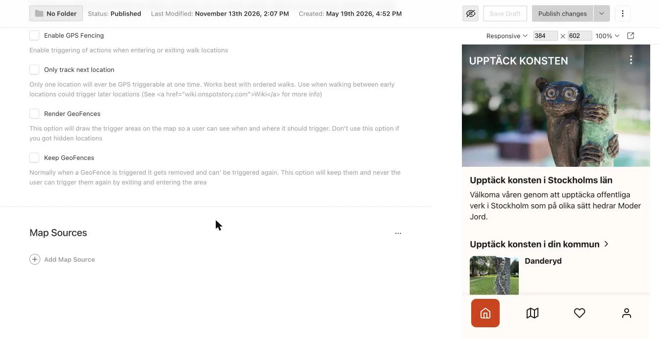
| Setting | Meaning |
|---|---|
| Enable GPS Fencing | Turns on geofences for the walk’s stops – notifications, auto-open and auto-audio on site. |
| Disable User-location when in walk | Turns off all location features in the walk: no blue dot, no geofences, no GPS prompt. Good for indoor walks. |
| Only track next location | Only the next stop can trigger. Prevents later stops from triggering when walking past them. Works best with ordered walks. |
| Render GeoFences | Draws the trigger areas on the map. Useful for testing – don’t use with hidden stops. |
| Keep GeoFences | An area can trigger again if the visitor leaves and re-enters. Normally each area only triggers once. |
Stop settings
Section titled “Stop settings”Locations → choose a stop → Location Specifics:
| Setting | Meaning |
|---|---|
| Auto Open | The stop opens automatically when the visitor arrives. |
| On Continue, Unlock Next Location | Pressing Continue unlocks the next stop. |
And under Basic Content → Audio:
| Setting | Meaning |
|---|---|
| AutoStart | Audio starts when the stop opens or is triggered on site. |
| GPS Locked | Audio can only be played within the stop’s area. The message shown otherwise is set in the walk’s GPS Lock Message. |
Hands-free walk
Section titled “Hands-free walk”For a walk where the visitor just walks and listens:
- Walk: Enable GPS Fencing on, ideally Ordered Walk and Only track next location.
- Each stop: Auto Open on.
- Each stop’s audio: AutoStart on.
Treasure hunt – unlock stops in order
Section titled “Treasure hunt – unlock stops in order”- Walk: Ordered Walk on (Walk Specifics tab).
- Stops: On Continue, Unlock Next Location on.
- Combine with Play & share and quiz questions.
Custom area shape
Section titled “Custom area shape”Instead of a circle you can draw an area of any shape (polygon), e.g. a park or a square:
- Open the stop → Location Specifics → Map Sources → Add Map Source → Map Polygon Block.
- Give the area a Slug.
- Add the corner points under Coordinates (Latitude/Longitude) in order around the area.
You can get polygon coordinates with e.g. Keene State Map Tool – check the lat/long order.
GPS notification or push notification?
Section titled “GPS notification or push notification?”- GPS notification – “you’ve arrived at a stop”. Created locally on the phone.
- Push notification – a message you send out. See Push notifications.
Permission levels on the phone
Section titled “Permission levels on the phone”Visitors can choose: don’t allow GPS, allow only while using the app, or allow in the background too (then the app can notify even with the phone in a pocket). Background GPS requires the feature to be enabled in the app and is reviewed more strictly by Apple and Google.
AI answers can be wrong – check the linked pages.