
Locations – create a stop
A Location is a stop in a walk. It has a position on the map and can contain text, images, video, audio, questions and more – in several languages.
Create a stop – step by step
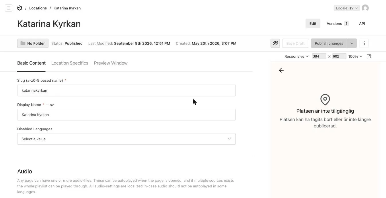
Section titled “Create a stop – step by step”- Open Locations → Create New (or + from the walk).
- Basic Content tab:
- Slug – technical name, only a–z and 0–9, e.g.
katarinakyrkan. - Display Name – the stop’s name in the app.
- Media List → Add Media Block → Image Block (or Video Block). Choose an image from the media library or upload a new one. Add more for a slideshow.
- Content Blocks → Add Content Block → Text Block, and write the stop’s text.
- For audio: Audio → Sources → Add Source and choose the audio file.
- Slug – technical name, only a–z and 0–9, e.g.
- Location Specifics tab:
- Fill in Coordinates – see Set the position.
- MapMarker can be left empty – the app uses its built-in markers. See Map markers.
- Click Publish changes (or Save Draft).
- Link the stop to a walk if you didn’t create it from there.
- Switch language with Locale in the top right and fill in texts, audio and captions for the next language.
Set the position
Section titled “Set the position”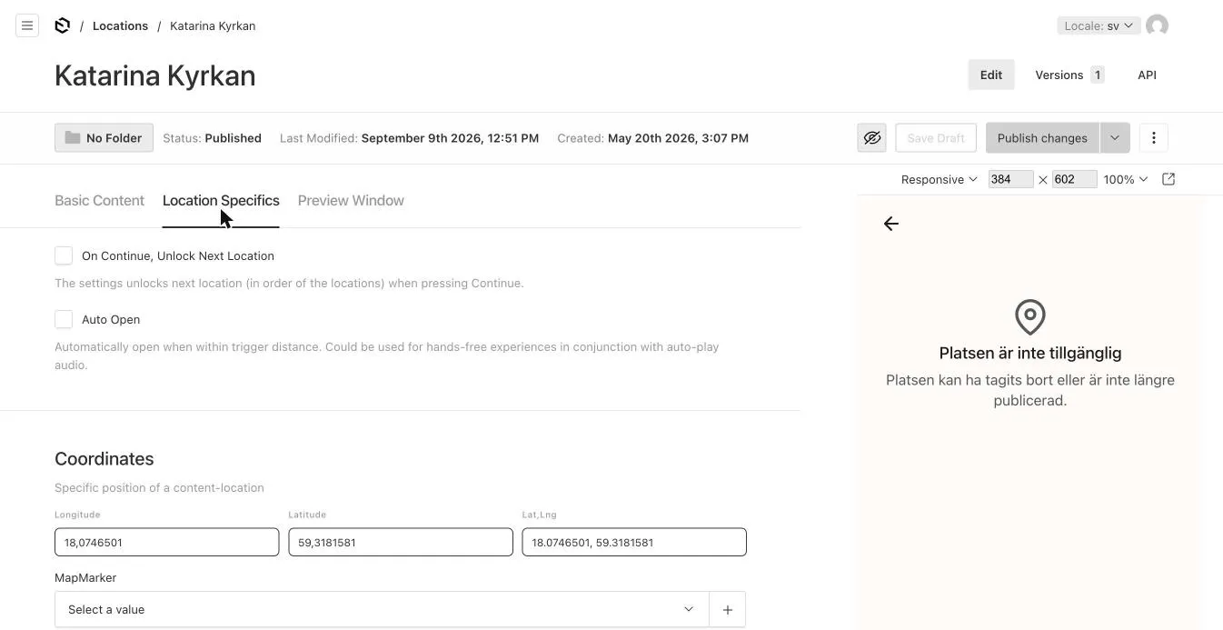
Under Location Specifics → Coordinates there are three fields:
- Longitude and Latitude – in decimal degrees, e.g.
18.0746501and59.3181581. - Lat,Lng – paste both at once.
Find coordinates in Google Maps: right-click the place in Google Maps – the top line of the menu is the coordinates (latitude, longitude). Click to copy.
What a stop contains
Section titled “What a stop contains”| Part | Where | Tips |
|---|---|---|
| Slideshow | Basic Content → Media List | The first image is the stop’s main image. Images and video can be mixed. See Images. |
| Text | Basic Content → Content Blocks → Text Block | 200–300 words is about right. See Text and formatting. |
| Audio | Basic Content → Audio | One or more audio files per language. See Audio. |
| Video | Media List → Video Block, or Content Blocks | See Video. |
| Quiz question | Content Blocks → Question Block | See Quiz. |
| Other blocks | Content Blocks | Banner, list, grid, accordion … See Content blocks. |
Location Specifics settings
Section titled “Location Specifics settings”| Field | Meaning |
|---|---|
| On Continue, Unlock Next Location | Pressing Continue unlocks the next stop. Used in treasure hunts and ordered walks. |
| Auto Open | The stop opens automatically when the visitor comes within trigger distance. Good for hands-free experiences, together with auto-start audio. |
| MapMarker / Mapmarker Select | How the stop looks on the map. See Map markers and filters. |
| Find Here Button | Shows a Find here button that opens the phone’s map app with directions. |
| Map Sources | Custom image, video or area on the map for this stop. See Custom map image. |
Missing translation for a stop
Section titled “Missing translation for a stop”Does the walk have 10 stops in Swedish but only 8 translated into English? Open the stops without a translation and choose the language under Basic Content → Disabled Languages. The stop is then hidden for that language.
Preview Window
Section titled “Preview Window”Display Preview (Basic Content) and the Preview Window tab control how the stop appears in lists and search results: name, short description and image. With Lock to original the values are taken from the stop automatically.
Reusing a stop
Section titled “Reusing a stop”The same stop can be linked to several walks. Editing the stop changes it in all walks. Want a separate variant? ⋮ → Duplicate and edit the copy.
AI answers can be wrong – check the linked pages.